Project Partners & Catchments
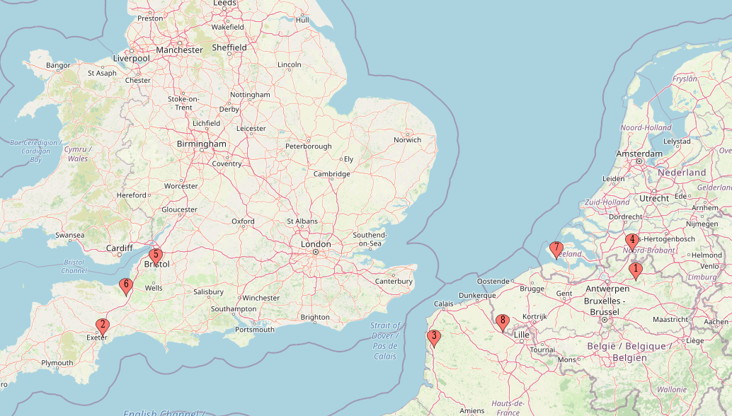
| Catchments | Key characteristics |
| 1. Laakbeek, municipality Beerse (BE) | Small brook passes through the semi-urban village with flooding history. Not much space for adaptation measures. |
| 2. the Culm River (UK) | Brook passes a new ‘green’ development area and main railway. Flooding is the main HMH causing deterioration in water quality. |
| 3. Liane (FR) | Brook passes a rural area with urbanized banks causing flooding and soil erosion. |
| 4. Aa of Weerijs (NL) | Brook passes a rural area with a high density of tree nurseries for export. Main HMH is drought due to high water demand and flooding in moments of peak flows. |
| 5. Porlock Vale (UK) | Brook passes a steep valley, creating a high risk of flooding in several villages. |
| 6. Somerset Levels and Moors (UK) | Flooding at lower reaches in several villages. |
| 7. Vlissingen (NL) | Channelized brooks pass through the new ‘green’ development area. Flooding is the main HMH. |
| 8. West Flanders (BE) | Brook passes between two villages and has a history of flooding. |

